
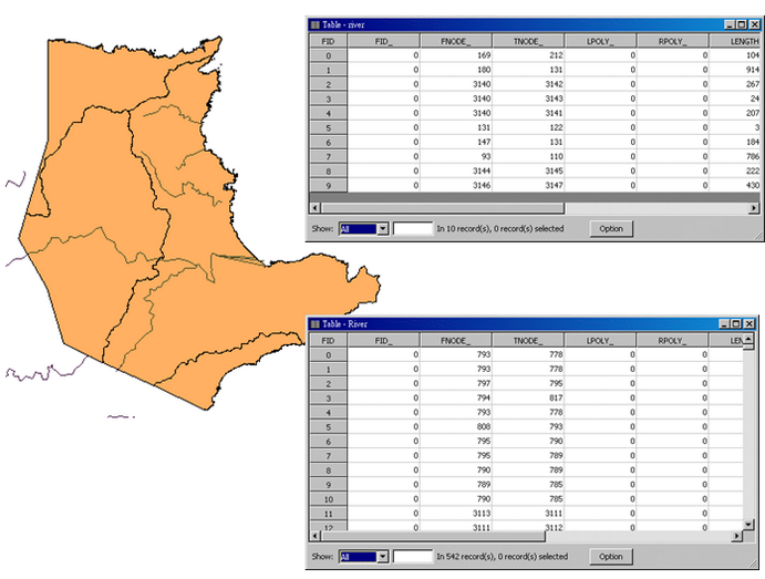
Overlapped features
When both of the target layer and joined layer are both polyline layers, one of the operation is “Each line will be given all the attributes of the line that is part of.” This function can join the attribute data of the overlapped polyline features of the two layers. If you have two polyline layers recording the rivers' data, and the two layers overlap, you can use the spatial join operation to view the attribute data of overlapped part of the two layers. In this sample, we use the layer “river” in Northeast Coast and the layer “River” in Yilan as the example. Due to the features from different layers, the data are recorded in different attribute tables. Therefore, you can apply the spatial join function to view the attribute data of rivers within Northeast coast, and the data of Yilan are recorded in the same attribute table as well.
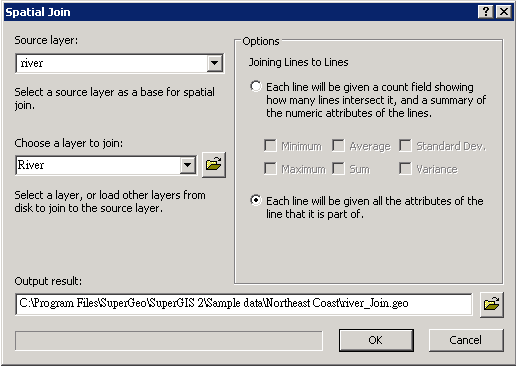
To join the two polyline layers, firstly open "Spatial Join" window, choose “river” of Northeast coast for "Source Layer", and choose “River” of Yilan for "Choose a Layer to Join." Then, click “ Each line will be given all the attributes of the line that is part of.” As the path for saving the output result is confirmed, click "OK."
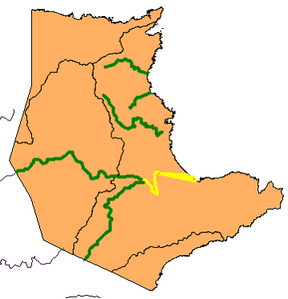
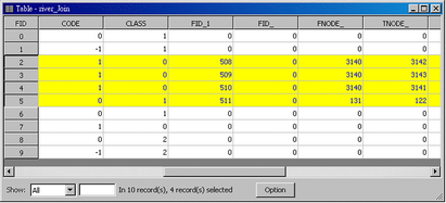
The new created layer will be added as the top layer on the map. As the attribute table is open, you can find that besides the attribute data of the original layer the attribute data of the joined layer are added, too. The attributes of the overlapped features are displayed in the table; the attributes of the features which are not overlapped are displayed 0 in the field. The overlapped features and their attribute data are displayed with the selection color in the figure below.
©2015 Supergeo Technologies Inc. All rights reserved.