
Feature intersection
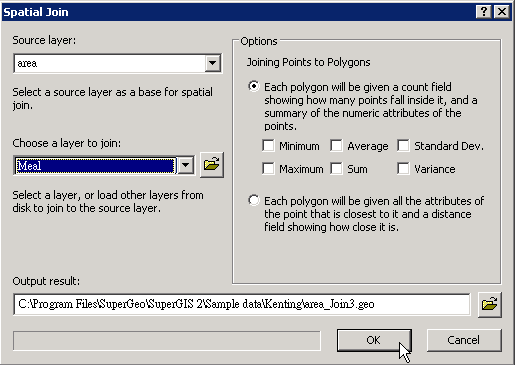
When you would like to know what intersects a layer, for instance, if you would like to know how many restaurants in a certain area, you can utilize a polygon layer covering an area and a point layer recording the data of restaurants to find out how the two layers intersect. Take the layers “meal” and “area” for example. “Meal” layer includes lots of point features; “area” is only composed of a polygon feature. If you want to know how many features of “meal” located in “area”, please open "Spatial Join" window, choose “area” for "Source Layer", and choose “meal” for "Choose a Layer to Join." Then, choose “ Each polygon will be given a count field showing how many points fall inside it, and a summary of numeric attributes of the points.” After the path for saving the output layer is confirmed, click "OK."
.png)
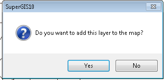
As the operation is finished, the system will show “Do you want to add this layer to the map?” If you click "Yes", the new layer will be added to the current project.
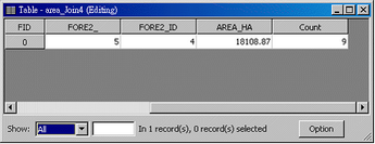
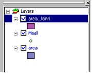
The new created layer will be added as the top layer on the map. When you open the attribute table of new layer, you can find that one field, “Count”, is added to the table, and the new field records how many features of “meal” intersect “area.” The field of count results will display in the table next to “Count” field if any count field was ticked.
NOTE: Since the target layer is a polygon layer, the new joined layer is a polygon layer. The spatial join method described above can not only apply to polygon layer and point layer but also other layers.
©2015 Supergeo Technologies Inc. All rights reserved.