
Intersect
"Intersect" computes the geometric intersection of two layers and creates a new layer only containing the features in the common area of the two layers. The attribute table of the new layer lists the data of the two layers. What should be noted is that the intersection must be performed on polygon and polygon layers, point and polygon layers, or polyline and polygon layers. The intersection cannot be performed on point and point layers, polyline and polyline layers, and point and polyline layers.
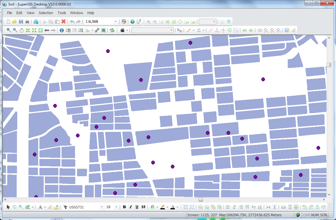
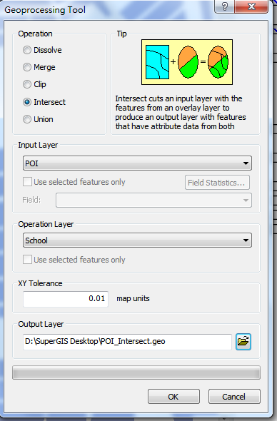
In this sample, we take the "POI" layer and "School" layer for example. If you would like to intersect "POI" layer and "School" layer, please open "Geoprocessing Tool" window, choose "Intersect." Then, select "POI" for "Input Layer", select "School" for "Operation layer." As the path for saving the output layer is confirmed, click "OK." The figure below is the map before intersection, and the attribute table of POI layer.
.png)
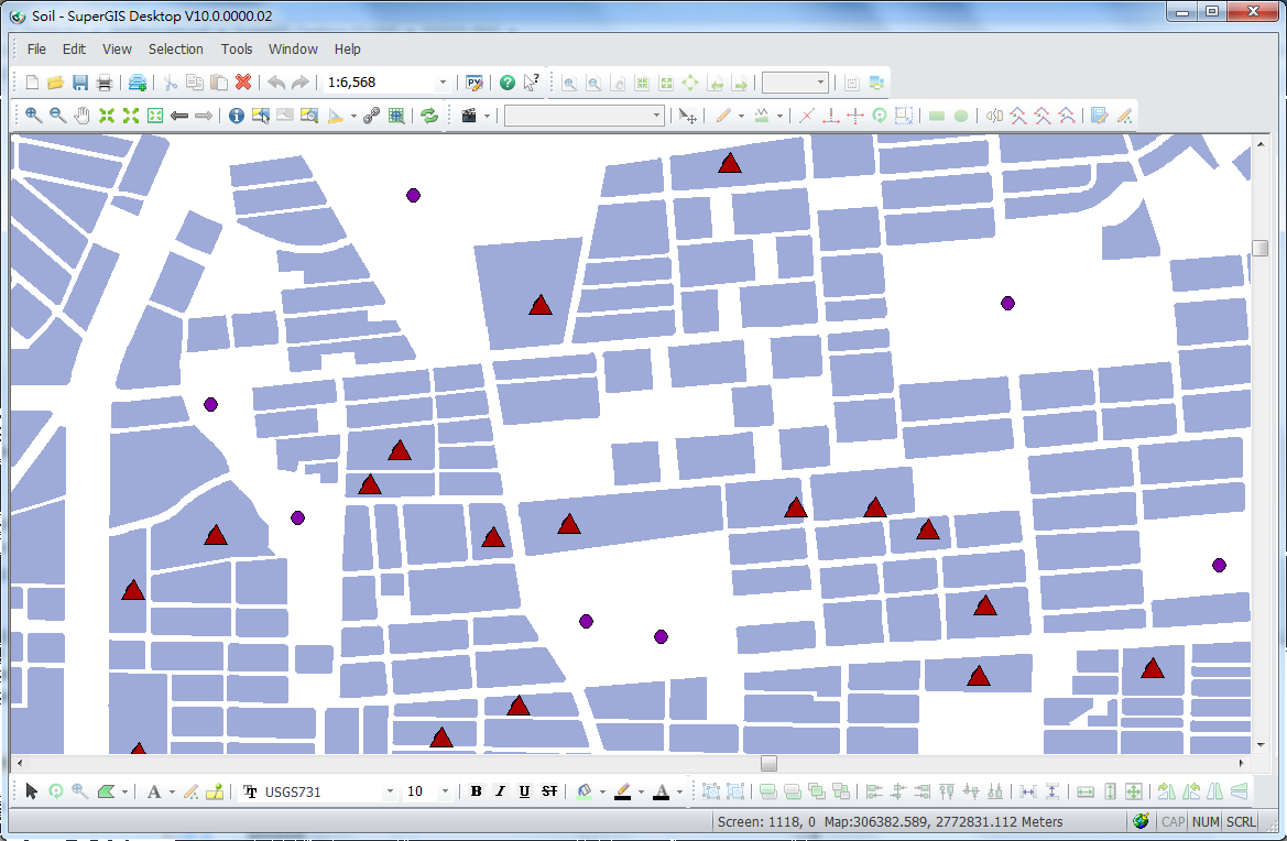
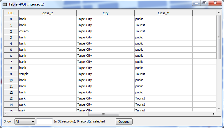
After intersection, the new point layer will be displayed as the top layer on the map. Like the figures below, the attribute table contains the attributes of the point layer and the polygon features.
Intersect the selected features
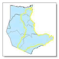
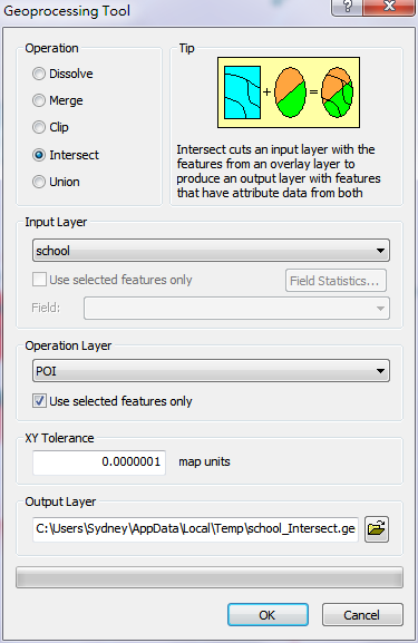
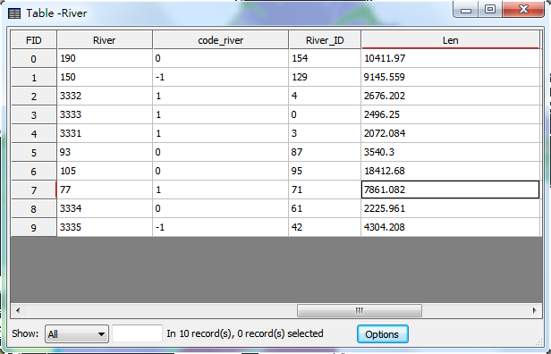
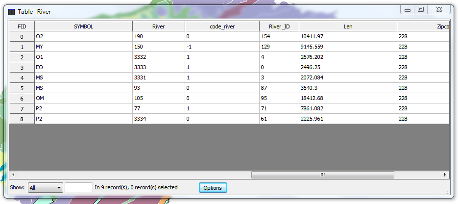
When performing Intersect operation, users can only intersect the selected features. In this sample, we take the layers “river” and “town” for example. If you would like to find the features of the polyline layer “river” within the selected area in the polygon layer “town”, please select the features first. Then, choose "Intersect" for "Operation", select “river” for "Input Layer", select “town” for "Operation Layer" and also tick "Use Selected Features." As the path for saving the output layer is confirmed, click "OK." The figures below are the selected area for intersection and the attribute table of “river” layer.
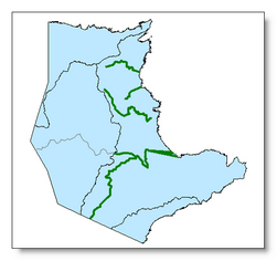
As the intersection is completed, the new created polyline layer will be added as the top layer on the map, like the figure below. The attribute table of the new layer contains the data of the original polyline layer and the polygon layer.
NOTE: To perform intersection operation with the selected features, the features of "Input Layer" and "Operation Layer" can be selected for intersection.
©2015 Supergeo Technologies Inc. All rights reserved.