
Clip
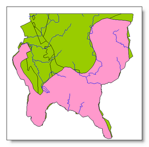
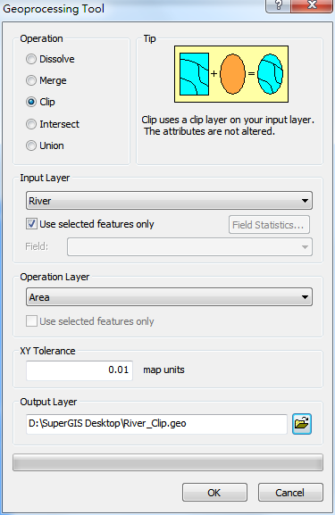
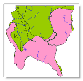
"Clip" is to clip the features with the polygon layer and to extract the features from the input layer. Therefore, to implement "Clip" operation, the "Input Layer" can be any geometric type of layers, but the "Operation Layer" must be a polygon layer. Take the layers “river” and “area” for example. If you would like to extract the “river” within the “area” to create a new layer, please open "Geoprocessing Tool" window, choose "Clip" for operation, select “river” for "Input Layer", and select “area” for "Operation Layer." After checking the path for saving Output Layer, click "OK."

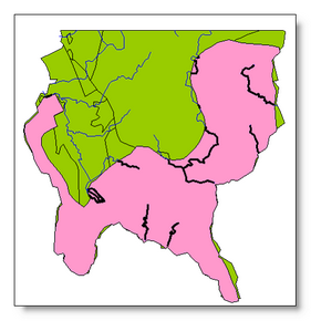
As the new clip layer is created, it will be displayed on the map as the top layer.
Clip the selected features on the input layer
Users can only clip the selected features. First of all, select the needed features on the map, open "Geoprocessing Tool" window. Then, choose "Clip" for "Operation", select “river” for "Input Layer", and tick “Use selected features.” Also, select “area” for "Operation Layer", confirm the path for saving Output Layer, and click "OK."
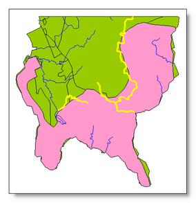
The new layer is created and displayed as the top layer on the map with the bold lines.
©2015 Supergeo Technologies Inc. All rights reserved.