
Dissolve
“Dissolve” creates a new layer by merging adjacent polygons that have the same attributes and removes the boundaries of the polygons. In SuperGIS Desktop, it is the only operation which can be performed on one layer. The others all involve two-layer operations.
Take Northeast Coast layer for example. If you would like to dissolve the EDESC field in geology, please open "Gepprocessing Tool" window and choose "Dissolve." Then, choose geology for the input layer and choose "EDESC" for "Field." As the path for saving output layer is confirmed, please click "OK." As the features are dissolved, the message window “Do you want to add this layer to the map?” will show. Click "Yes", and the layer will be added as the top layer.
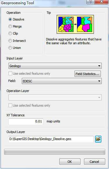
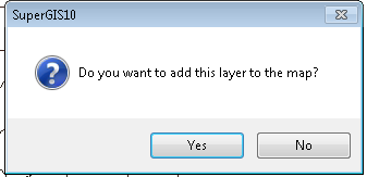
Figure 1 shows the features before being dissolved and their attribute table; Figure 2 displays the dissolved features and their attribute table.
Figure 1
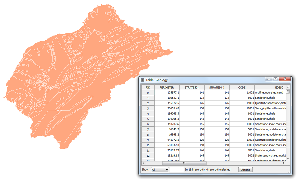
Figure 2
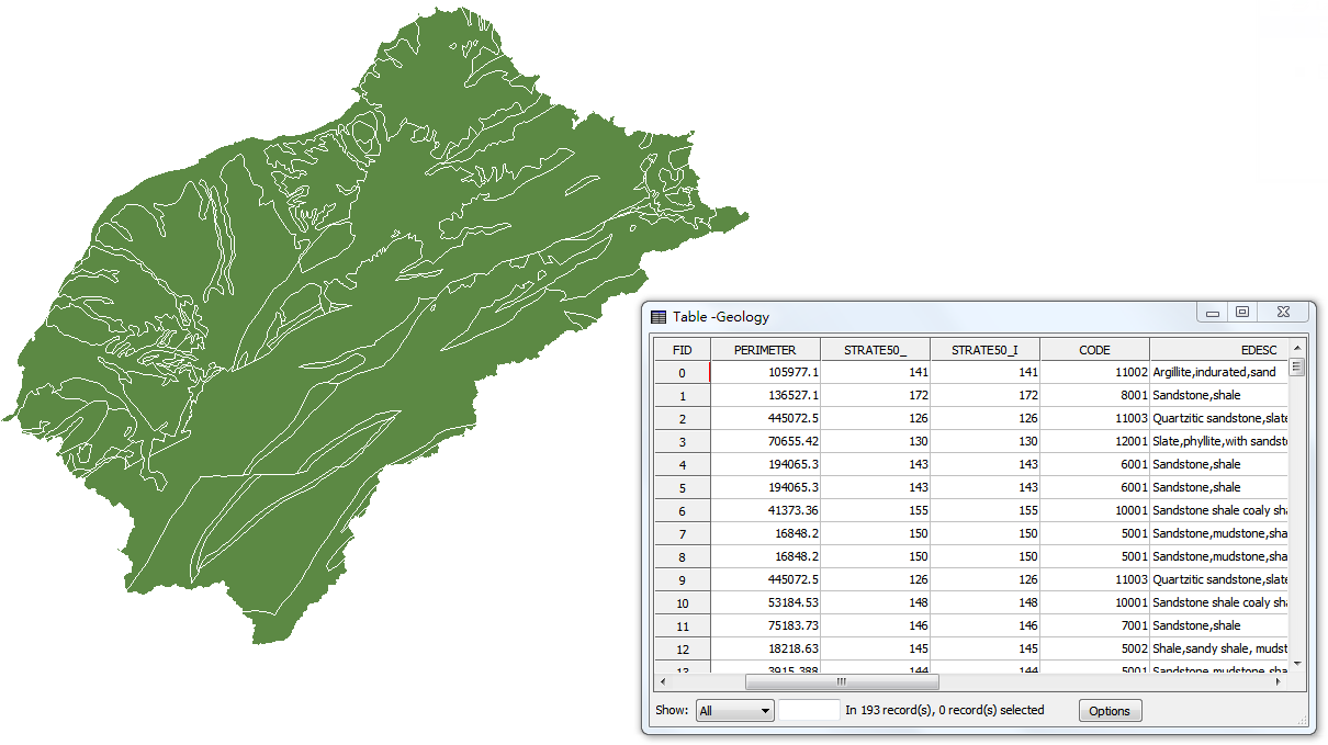
Since the field for dissolve is geologic data field, the features with the same geologic data are dissolved as one feature. Therefore, some of the boundaries of the features are altered.
©2015 Supergeo Technologies Inc. All rights reserved.