
Adding XY data
You can add the coordinate data of point features to SuperGIS Desktop to add point features. cx
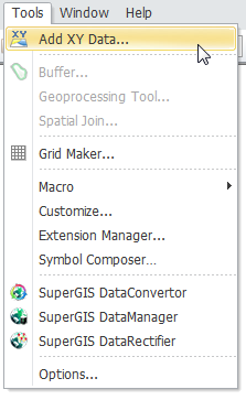
1. Click "Add XY Data" in "Tools" menu on the top menu bar to open "Add XY Data" window.
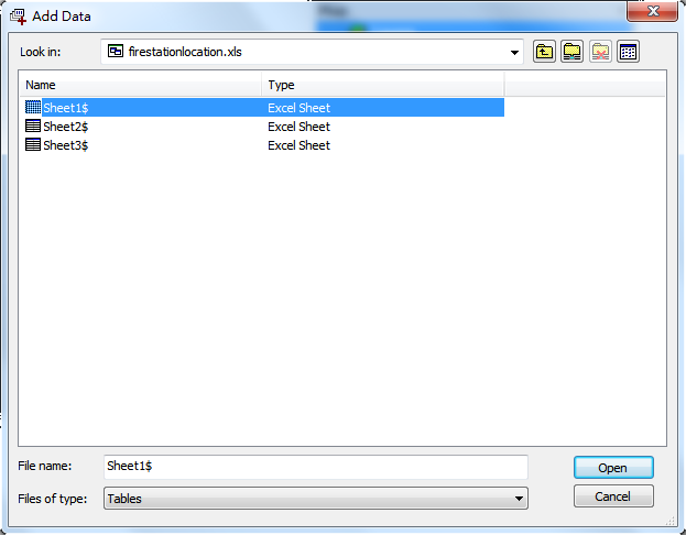
2. Then, click ![]() to open the file which records XY data (for example, the Excel file, “import” created in the previous section). Then, click "Open."
to open the file which records XY data (for example, the Excel file, “import” created in the previous section). Then, click "Open."
.png)
3. In "Add XY Data" window, you need to specify the tab of the excel file you store the data and the columns of XY coordinates.
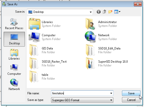
4. Then, click "OK", and "Save as" window appears. Choose the position to save the file and name the file as "Point." Click "OK" to complete the setting.
5. As for the contents of the drop-down menus of X Field and Y Field, the system can automatically recognize the text title. In this sample, the system can recognize the titles, “X coordinate” and “Y coordinate” in the file. If you do not type any title, the system will use F1 to represent Field1 and F2 to represent Field 2.
6. The map window will display the point features which are recorded in the Excel file; the "Data Content" window will display the “Point” point layer as the top layer.
.png)
NOTE: SuperGIS Desktop can automatically recognize which fields are numeric. Thus, as you are choosing the field for XY coordinates, the drop-down menu will show the names of numeric fields only for users to choose. When the data are added to the map, the color of the features displayed in the map window and the "Data Content" window are selected randomly. You can modify the color and symbol of the features in "Symbology" tab in "Properties" window.
©2015 Supergeo Technologies Inc. All rights reserved.