
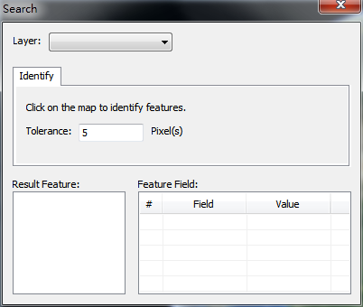
Identify
1.Click identify tool ![]() .
.
2.Set the target layer.
3.Set tolerance value. By default it is 5 px
4.Click the target feature in the 3D map.
5.The identified features will be listed in the Result Feature list. Left click to see its attributes in the Feature Field list; Right click to select to zoom to that feature.
© 2016 Supergeo Technologies Inc. All Rights Reserved.