
Managing Spatial Data—PostgreSQL
1. When you use SuperGIS DataManager to connect to PostgreSQL Geodatabase successfully, you can manage the data in the Geodatabase.
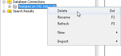
2. Right-click the PostgreSQL Geodatabase and click Delete on the menu. Then, the connection to the Geodatabase will be stopped.
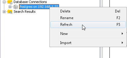
3. Right-click the PostgreSQL Geodatabase, choose Refresh on the menu. Then, Geodatabase will be updated.
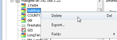
4. Select a spatial data under PostgreSQL Geodatabase, right-click it, and choose Delete on the menu.
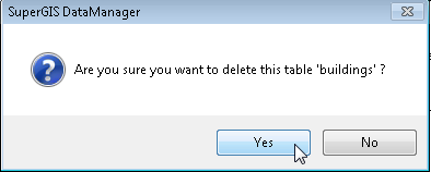
5. Click yes in the message, and the spatial data will be deleted from the Geodatabase. Click No, and the deletion will be canceled.
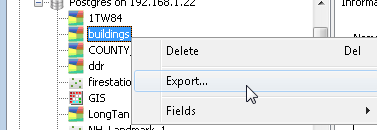
6. Select a spatial data under PostgreSQL Geodatabase, right-click it, and choose Export on the menu.
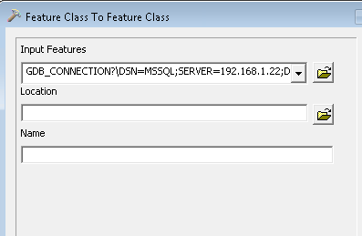
7. In Feature Class To Feature Class window, input the location for saving the exported file, name the exported file and click Save. The spatial data will be exported as a file.
NOTE: The actions of managing the spatial data can be manipulated in Information tab in Data Display area as well. SuperGIS DataManager supports to export the data in Geodatabase as Geo and Shp file types. The file type can be set in Type in Save as window as you export the data.
© 2015 Supergeo Technologies Inc. All Rights Reserved.