The User Interface of SuperGIS DataConvertor
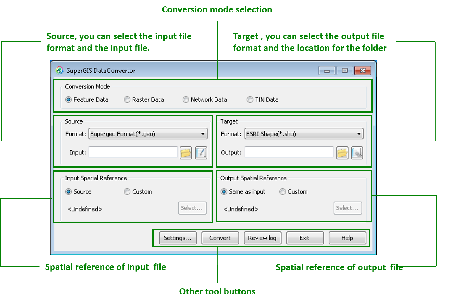
SuperGIS DataConvertor is the data conversion tool converting vector data, raster data, and NRT data. The top of the interface is to set Conversion Mode. The second part is to set the input and output layer and its spatial references. The bottom of the interface includes the tool buttons for you to view the user guide, implement conversion, view the conversion log, and set other advanced settings.
© 2017 SuperGeo Technologies Inc. All Rights Reserved. |