Options
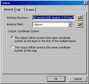
General Before analyzing, users are allowed to modify the default settings of analyzing environment in "Options" window, including exporting "Working Directory", "Analysis Mask" and "Output Coordinate System."
"Analysis Mask" determines the target areas for system to operate. Mask can be raster or vector layers. Only the pixels inside the target areas could be operated. Those pixels outside the target areas will be assigned to NoData.
According to the default, the output will be saved in the same coordinate system as the input of the first of the multiple inputs. Besides, users are also able to save in the same coordinate system as the map.
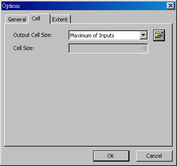
Cell To set the cell size of the output raster; it determines the resolution of the output raster. The default cell size of the output raster is "Maximum of Inputs" (the maximum cell size of the input raster). Besides, users can set "Minimum of the Inputs", "As specified below" or "Same as Layer."
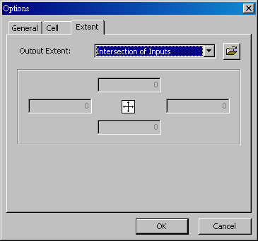
Extent Set the extent by entering the four end points or by specifying the exterior file. Many topology relationships are available (intersection, union, visible extent, full extent).
©2016 Supergeo Technologies Inc. All rights reserved. |