Thiessen Polygon
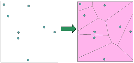
The feature of Thiessen polygon is that each polygon contains an input point and the distance between each location in the polygon and the input point is closer than any other input points in other polygons. The polygons drawn under the condition are called Thiessen Polygon.
The extent of the polygon is the extent of the points used an additional 10% plus by default. Moreover, there is no limit of the number of points of the point layer. Also, you can use the selected point features only to draw the Thiessen Polygon.
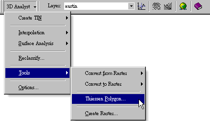
Using Thiessen Polygon 1.Click the 3D Analyst menu, select Tools, and choose Thiessen Polygon.
2.Thiessen Polygon window appears.
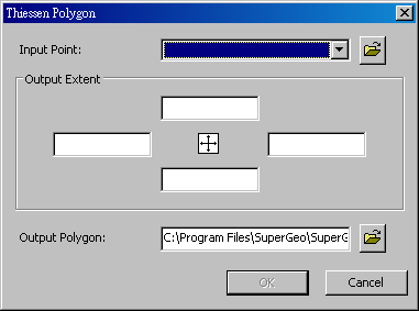
3.In Input Point, choose the layer you would like to create a polygon feature from. 4.Click 5.The extent of the polygon is the extent of the points used an additional 10% plus by default. Or you can specify the output extent by yourself. 6.Click OK to add the polygon layer to the map window.
©2016 Supergeo Technologies Inc. All rights reserved. |