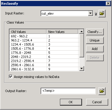
<< Click to Display Table of Contents >>

3D-Analyst-Extension-Help


Reclassify


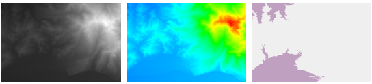
"Reclassify" means that when the input raster values can not satisfy analyzing command, users are able to replace those old values with new ones and output a new raster. It enables users to utilize substitute values, specified interval values or region reclassification to alter one or a group of raster values each time. For instance, to complete reclassifying through integrated classifications, users can classify different sorts of values into a unique sort to simplify or combine some categories, or reclassify various raster by intervals based on sensitivity, priority, etc.


41.1


reclassify_enu


Description of Parameters

Item

Description

Data Type

Input Raster

The data raster to be reclassified.

Raster layer

Classify

Reclassify the original value of the raster based on the specified method and condition.

Analysis option

Unique

Classify the cells of same value into same class.

Analysis option

Add

Add class.

Analysis option

Delete

Delete class.

Analysis option

Assign missing value to NoData

Treat the cell values that are not contained in the reclassified list as NoData.

Analysis option

Output Raster

The filename and path of the output raster.

Raster layer


©2016 Supergeo Technologies Inc. All rights reserved.