Viewshed
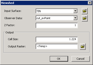
With Viewshed tool, the visible locations for one or multiple observer points or lines can be determined. Every observer point is located at different elevation, so the visible location differs. In the output value, the cell that is visible from the observer point is assigned 1; the cell that is invisible from the observer point is assigned 0. Observer point or line is acceptable. As to the observer line, its vertices will be treated and used as the observer points.
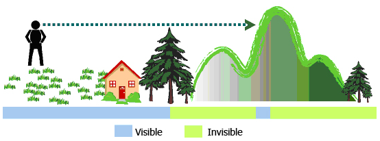
See the figure above, a man is standing at the centroid higher than the lawn, house and woods, so he can see all the spots mentioned. In the figure, the blue part refers the visible extent, green refers the invisible extent. To some locations, they are invisible due to being hidden by the foreground.
Why using Viewshed? In the normal process of overlapping layers, it is impossible to know the visible extent of each point, so there are some blind spots in the plan. If we know the visible extent and what can be seen in a region, the plan can be designed in a way fitting more demands.
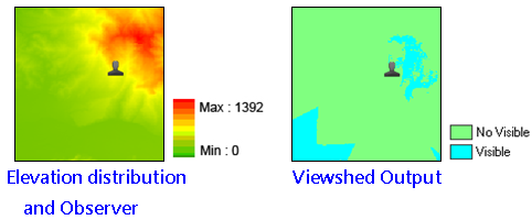
See the figure in the upper left side, we know the elevation of the triangulation station but do not know which location is visible for it. See the figure in the upper right side, overlap the layers that is performed with Viewshed analysis, transparency and hillshade analysis with the terrain map, we can realize easily the relationship between the observer point and terrain.
Description of Parameters
©2016 Supergeo Technologies Inc. All rights reserved. |