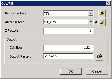
Cut/Fill
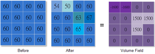
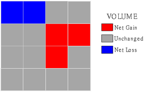
Cut/Fill analysis analyzes the change on the surface area and volume of an identical region in different periods of time. Cut/To two maps at the same location in different periods of time, the Fill tool effectively exhibits the addition, removal or no change.
Cut/Fill tool not only displays the change of surface but also quantifies the change. The output value of Cut/Fill could be positive, negative or 0. If the output value is negative, it represents the deposition is running at the site; if it is positive, it represents the erosion and removal occur at the location.
Cut/Fill analysis helps analyze the deposition or erosion condition in a valley. Or it helps calculate the area or volume of the surface material to be removed or filled at the construction site. Or it helps find a stable region suitable for habitat where the water periodically overflows.
Description of Parameters
©2016 Supergeo Technologies Inc. All rights reserved. |