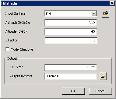
Hillshade
Hillshade analysis simulates the illumination of the earth surface by setting the hypothetical position and the altitude of light source. With the tool, the visualization of the surface for analysis or the graphical display can be greatly enhanced, in particular when using with transparency.
The hillshade parameters Before Hillshade analysis, the position of light source must be considered.
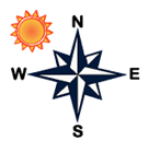
Azimuth The azimuth is the angular direction of the sun, from the north to the south, from the east to the west. The degree starts from the north in clockwise direction till back to the north, degrees from 0(the north) to 360(still the north). The default azimuth is 315º (NW), please see the figure below.
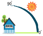
Altitude The altitude is the slope or angle of the light source to the horizon, from 0 degree(on the horizon) to 90 degrees (overhead). The default is 45 degrees, please see the figure below.
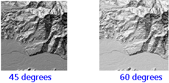
To do hillshade analysis, you need a DTM. The system will overlap the hillshade based on the azimuth and altitude settings to the DTM. See the figures below, you can find the different result for different altitude settings.
Model Shadows Model Shadows assigns the cells in the shadow region 0, and the rest cells are assigned values of integers from 1 to 255. By default (not to model shadows), the system calculates each cell to get whether it is located in the shadow based on the partial illumination.
With the Hillshade analysis, users can overlap the different layers (land use layer, terrain layer, river layer, road layer) with the analysis result (transparency) to enhance the visual display.
Description of Parameters
©2016 Supergeo Technologies Inc. All rights reserved. |