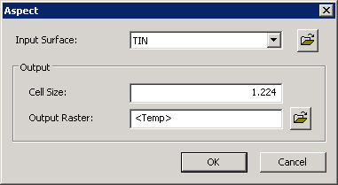
Aspect
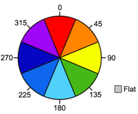
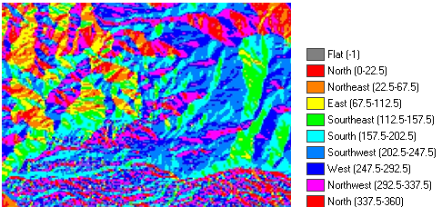
Aspect tool calculates the two neighboring cells, the direction with the greatest change in value will be considered as the slope direction or the surface slope. In calculation, the aspect is divided into 360 degrees: the north is 0 degree, ascending in clockwise direction till 360 degrees back to the north. The flat area has no direction, and will be represented by -1. Please see the figure as below, 337.5-22.5 degrees is N, 22.5-67.5 degrees is NE, 67.5-112.5 degrees is E, 112.5-157.5 degrees is SE, 157.5-202.5 degrees is S, 202.5-247.5 degrees is SW, 247.5-292.5 degrees is Wand NW is between 292.5-337.5 degrees.
With Aspect analysis, you can figure out: 1.The influence to mountain ecology: to calculate the influence of sunlight hours, rainfall, and radiation in a specific region. 2.Search the flatter terrain: to plant vegetables or fruits in these fields. 3.Evaluate the direction of water: as the basis for policy-making in flood prevention.
Description of Parameters
©2016 Supergeo Technologies Inc. All rights reserved. |