Surface Analyst
Surface Analyst can analyze the existing rater layers to generate additional data, and the original data are not affected. Surface Analyst includes Slope Analyst, Aspect Analyst, Hillshade Analyst, Curvature Analyst, Cut/Fill Analyst, Contour Analyst, Viewshed Analyst and Extract Surface Value Analyst. Not only raster data, surface analyst also supports TIN data.
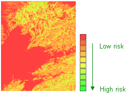
Slope Analyst When you want to get an understanding of the surface variance of an area, you should use Slope analyst. Only when you realize the surface variance of an area that you can profoundly explore the surface risk of it.
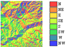
Aspect analyst Through Aspect analyst results, they have you understand the aspect of a surface in an area.
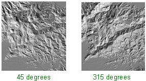
Hillshade analyst You can use Hillshade analyst for illustration and analytic purposes. For illustration purpose, you can take hillshade analyst graph as the background and get an understanding about how other layer data are in relation to surface distribution. For analytic purpose, you can set the azimuth angle to observe the surface situations from different hillshade.
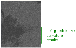
Curvature analyst Curvature refers to the average curve level between point A and point B. If A and B make a straight line, the curvature will be 0.
Cut/Fill analyst When you want to know the increasing or decreasing level of the surface material volume in an area at two different periods of time, Cut/Fill analyst should be the very useful method to it.
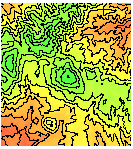
Contour line When you want to search regions with the same height, you will need to have the contour line for the terrain. Contour line will show you the contour line of terrain, through whole distribution you will find out the slope change of entire terrain.
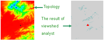
Viewshed analyst If you would like to know if a distant landscape could be reached by vision, you can apply Viewshed analyst to help you to understand the topographic relief of the location where you are and the area which could be reached by vision. If you would like know where the optimal vision is in an area, you can also apply Viewshed analyst to search for this location.
Overlaying a viewshed map on the topography enables you to see clearer the distribution condition of visible landscape. Please see below the graph of overlapping a result.
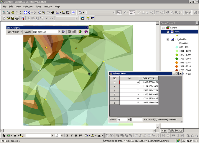
Extract Surface Values By entering the specified point data, “Extract Surface Values” enables users to extract elevation data of the specified points on the layer and save them as attribute data.
©2016 Supergeo Technologies Inc. All rights reserved. |